User Tools
Site Tools
Sidebar
Clipping project
Sample projects
Redo the project
- map search : “Cartoucherie Toulouse” + zoom level 15
- inputs : see Fichiers sources "Démo Clipping"
Key points
This project highlights the possibilities:
- search for an address on the map before defining its printing zone(s)
- perform clipping on a map in order to display a PDF drawing under the clipped areas
- apply a rotation to a drawing
A search was carried out on the map in order to centre it on the Cartoucherie de Toulouse, then the useful areas and axes were drawn, as well as an encompassing print area :

Then a PDF drawing showing the completed work was imported, the areas and axes of the map were duplicated, and the drawing has been georeferenced so that it could be superimposed on the map:

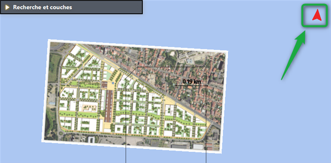
Note that since the PDF drawing is not oriented to the north, a correction was made with the map/drawing rotation tool to realign it on the map:

If one observes in the deliverable “Carnet 0” → “Month of 01-12-20” the status of the zone “Ext04” (and other adjacent zones) which is finished, one notices that it operates the drawing clipping of “Cartoucherie TOULOUSE” thus making it possible to show the result of the work:


